
- This event has passed.
Beach Mapping
January 4 - 10
Event Navigation
- « Shoreline Mapping with Andy
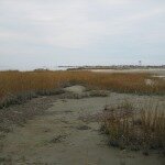
Look for Andy out on the Plum Island beach one day during the week of January 4! He will be using an RTK-GPS to continue the monthly mapping of the local shoreline at low tide. Be sure to swing by and say hi and discuss the project! You can learn more about what he is doing out there by reading our blog post: “Monthly Beach Mapping“
This January survey marks the 13th monthly survey of Plum Island, completing our goal of one full year (plus) of mapping the beach. Our first survey was on Dec 10, 2013. We’ll be back, but now on a less regular basis, such as after major storms.
+ Google Calendar+ iCal Import
 November 26, 2014 - Williamsburg, VA Two weeks ago, I had the opportunity to work with several collaborators from the University of North Carolina on a study of overwash […]
 October 29, 2014 - Gloucester Point, VA This came up in my facebook news feed today – a link to a blog post about the ongoing projects of our […]
 Posted: October 27, 2014
 Posted: October 14, 2014