
Shoreline Mapping with Andy
March 8 @ 8:00 am - March 14 @ 5:00 pm
Event Navigation
- « NSF Coastal SEES Meeting
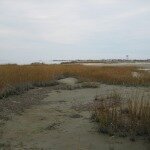
Plum Island has been walloped by storms these past weeks. Although we’ve officially ended our 14-month-long campaign of monthly beach mapping, we want to know how the beach has changed as a result of these storms (besides sewer backups and feet of snow on the ground) and how it is recovering. Thus, Andy will once again be out on the Plum Island beach sometime during the week of March 8. He’ll be using an RTK-GPS to once again map the local shoreline at low tide. Be sure to swing by and say hi and discuss the project! You can learn more about what he is doing out there by reading our blog post: “Monthly Beach Mapping“
+ Google Calendar+ iCal Import
 November 26, 2014 - Williamsburg, VA Two weeks ago, I had the opportunity to work with several collaborators from the University of North Carolina on a study of overwash […]
 Posted: January 28, 2015
 Posted: October 27, 2014